03 August 2007

Isla Taquile, Lake Titicaca

Lake Titicaca, Peru


Nestled between the Andes and the Altiplano, Lake Titicaca is the largest lake in South America. At over 12,000 ft. above sea level, it is the world´s highest navigable lake. It is also the cradle of Peru´s ancient civilizations, including the Inca. The myth goes that the first Inca, Manco Capac was born of the Sun god Inti here, and emerged from the Lake to bring forth the Inca Empire. There is a white statue of Manco Capac looking down over the port town of Puno (albeit with a cross in his hand).

Manco Capac looks down over Puno and Lake Titicaca
The sun is very brilliant over the water, the colors intense, and like everywhere in the Andes, the sky is always a dramatic display of clouds and light. Ride the boat out two and a half hours, and you will arrive at Taquile Island.


The island has been inhabited for thousands of years by a lineage of Quechua-speaking people who have maintained a distinct cultural identity from the peoples of the mainland. They have rich artisan traditions, including the knitting of hats (done by men) and weaving (by women). You can often see the men and boys knitting hats as they go about their daily routines on the island.


Boys practice their knitting skills


Kite-flying on Taquile

Tourism changes everything


Terra cotta pot, Taquile


Young girl in the village square

Earthen bricks drying in the sun


Young girl, Taquile


Man in traditional dress; hat design indicates that he is married


Floating Islands of Lake Titicaca

Lake Titicaca, Peru


The Uros are a Pre-Inca group of indigenous Peruvians who have lived for centuries on floating islands made from layers of the totora reeds that grow in the shallow areas of Lake Titicaca. The islands are built on a foundation of roots of the reeds, in meter-thick blocks, which are bound together and anchored to the bottom of the lake. Layers of reeds are then laid upon the root blocks, and are replenished regularly to replace areas that have rotted. Nearly everything else on the islands are also made from the reeds, including buildings, canoes, furniture, and toys for the children. Part of the root is also eaten as a staple of the Uros´diet, in addition to fish and rice.


A young Uros girl

Houses made of reed

Totora reed bundled and set out to dry
The life of a floating feline


Uros boy in a reed fishing boat

The morning´s catch

Reed boat

Eduardo, 15, takes us for a ride on a reed boat

01 August 2007

On the Trail of the Inca / Machu Picchu

(30 July)
Inca Trail - Machu Picchu, Peru
This one is for the ever fabulous ReneƩ Darvin.


Our last morning on the Inca Trail, we are up at 3:30am. The checkpoint five minutes downhill opens at 5:30am. The problem is there are many groups camped out, waiting to pass through the checkpoint when it opens, so we need to get there early to be at the front of the line. Once we are cleared, we have about a two hour hike to get to Machu Picchu. The anticipation is great, and the morning is still and quiet. At sunrise, we approach Intipata, the Sun Gate, from which the first views of the Machu Picchu citadel can be seen below. We´ve made it!


It´s almost another hour´s walk to get down to Machu Picchu, watching its stone contours and alleyways emerge below the rising sun. Illness, foot blisters, callouses, sore muscles, aches, and hammered knees all fade away. We are basking in the glow of arrival.


Already the buses are exhaling tourists from Auguas Calientas by the hundreds at this early hour, but at least we have the relative quiet of the morning to take in the vastness of the place. By noon, the site will be literally flooded - resembling an amusement park. The park regulations allow 2,500 tourists to enter per day. I feel entitled to my space, having walked for three and a half days to get here, but I too am one of the millions who are contributing to the demise of this precious jewel. A group of Japanese scientists recently found that the terraces at the edges of Machu Picchu are sloping downward at a rate of 2cm per month, due to the heavy traffic on the delicate site. It is not unforeseeable that this will be a site only visible from a distance at some point in the near future.


On the Trail of the Inca / Part Three

(29 July)
Inca Trail, Peru


On the third morning, we set off from camp into a mystical landscape of shifting clouds and light. We have about three hours ascent to reach the second pass at Qochapata (12,916 ft). I´ve recovered nearly 100%, and my stomach is feeling much more normal this morning. On the way to the top, we stop at the small Inca ruins of Runkurakay and pass by a small mountain lake.


It is customary on the Trail to pick up a stone at Runkurakay and carry it to the top, where you place it on a rock pile at the summit and make a wish.


From the Second Pass, we make a steep descent deep into the cloud forest, where the climate and plant life changes dramatically. We visit the Inca sites of Sayaqmarka and Phuyupatamarka and pass over our third and final pass at 12,000 ft.


Sayaqmarka


Sayaqmarka

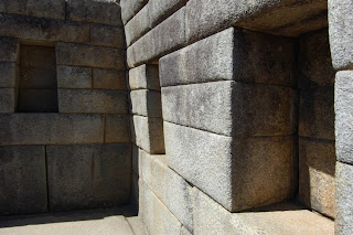
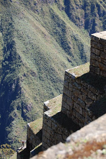
Sayaqmarka, built high on a mountain top, is believed to have been used by the Incas as an astronomical observatory. Just over the third pass, Phuyuptamarca ("city above the clouds") demonstrates well the Inca use of terraces, which were built to prevent erosion, but also served as agricultural areas.


Phuyuptamarca


Phuyuptamarca

The cloud forest is lush and green, and offers an unbelievable variety of plant species - bamboo, orchids, moss and lichens of every color and variety...